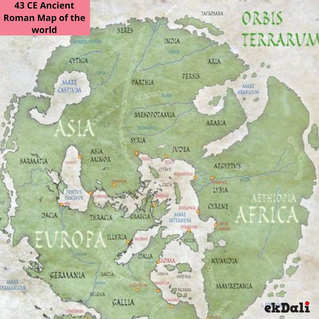
Rome was the most powerful kingdom during this period and they wanted to see themselves as the center of the world.
The Roman Orbis Terrarum was created by Pomponius Mela in 43 CE. This is how he saw the entire world. He divided earth into 5 zones of which only two were habitable.Pomponius Mela declares that People from these two zones cant cross over because of the unendurable heat of the intervening torrid belt.
Roman map-makers placed the East at the top of their maps.
The Romans used the verb oriri for "rising" when applied to the sun, moon and stars. Oriens meaning "the east", "the morning" or "the rising sun" came from this word. From this comes the English language word "Orient".
India occupied the South Easter part of Asia.
Source: Vividmaps
We make cool maps for kids, you may buy them here - Link to shop for World Map Poster


